Call us now 01722 718444
Acclimatisation Trek to Cotopaxi Viewpoint

Horatio's Garden Avenue of Volcanoes Trek 2024 9 days Ecuador

Trek
Trek
Hotel
Hotel
Altitude
Altitude
Terrain
Terrain
ORANGE 3
Grading


About the Challenge

Dates & Prices

Itinerary

Horatio's Garden Avenue of Volcanoes Trek 2024


BESPOKE 9 DAYS
The Avenue of the Volcanoes, named in the early 1800s by famous explorer Humboldt, is a volcano-lined corridor stretching south
through Ecuador. Many of these towering snow-capped cones are still active.

Between the volcanoes lies the dramatic Toachi canyon, flanked by verdant valleys of tropical forest and farmland dotted with
indigenous villages; our trek explores this diverse landscape, criss-crossing the steep-sided canyon on ancient trading paths
rising over 3000m. Our goal is the rim of Quilotoa (3870m), a vast volcanic crater known for its vivid turquoise lagoon.

With time to acclimatise to the altitude, this is a challenging trek through breathtakingly beautiful landscapes full of colourful
Andean culture. Time to explore Quito’s colonial old town and well-earned relaxation in hot springs book-end an unforgettable
experience
  • Flight may be day-time or overnight; if evening arrival we transfer to hotel; dinner and trip briefing (time permitting). Night hotel/in flight.

  • Quito, located close to the equator in the foothills of the Andes, lies in a long, narrow valley at the base of the Pichincha volcano. It is one of the best-preserved colonial cities in the Americas, and was declared a UNESCO World Heritage Site over 40 years ago. We spend the morning exploring the beautiful old town, soaking up the cobbled streets and colonial architecture. In the afternoon, you can explore independently or take the opportunity to visit a community foundation to see the work they do in supporting local street children. At an elevation of 2850m, our bodies will already be acclimatising to the altitude. Night hotel.

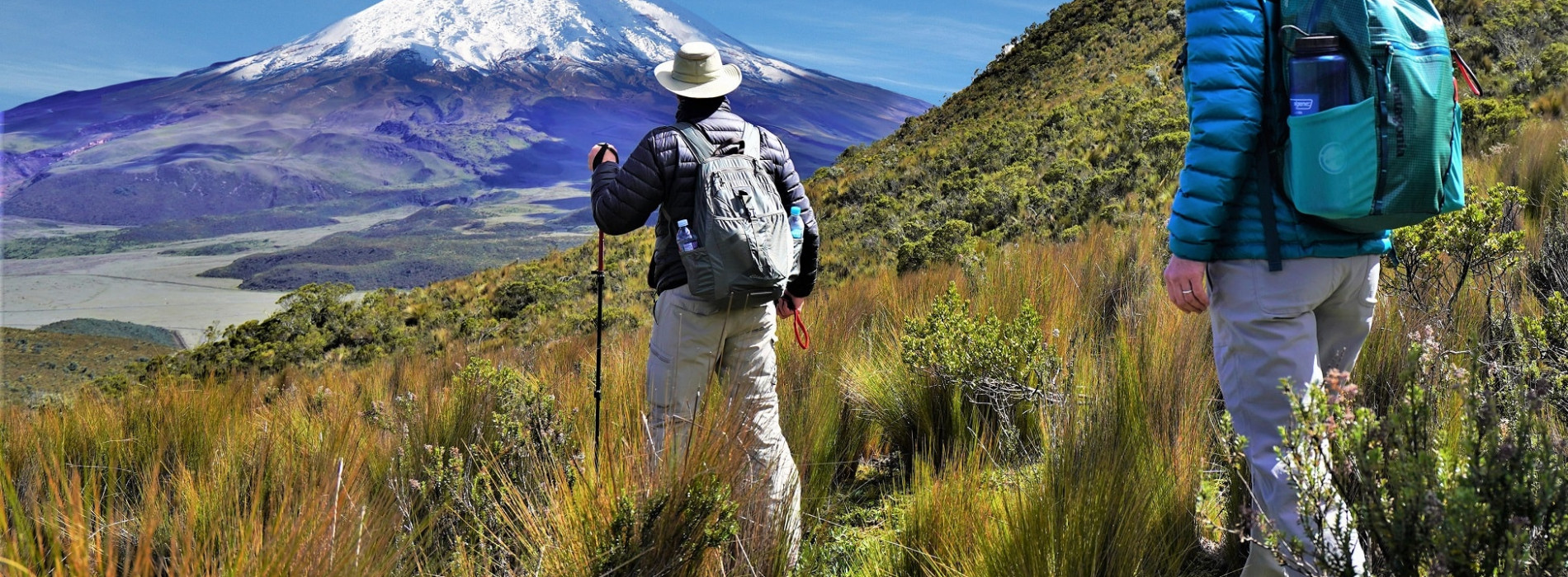
  • An early start sees us heading out of the city through the Avenue of Volcanoes to Cotopaxi National Park. Cotopaxi is one of the most famous active volcanoes in the world, and Ecuador’s second-highest summit. Our warm-up trek takes us onto the slopes of nearby Rumiñahui, an impressive volcano in its own right, where we follow trails uphill from beautiful Limpiopungo Lake towards the central summit of this rocky mountain (its Quichuan name means ‘rock face’.) Not only are we rewarded with magnificent views over Cotopaxi’s symmetrical snow-capped cone, but, in heading up to approximately 4000m, this trek aids our acclimatisation for the coming week and kicks off our challenge in style. The surrounding views are magnificent. After descending, we transfer to a charming hacienda on the outskirts of the Park; from its grounds you can see both Cotopaxi and the Illinizas, a distinctive pair of volcanic mountains. Night lodge.

    Trek approx 4-5 hours; total drive approx 2-3 hours

  • A scenic start as we drive through a majestic landscape of steep green hills, with great views of Illizina Sur. Dairy farms, fields of crops and native forest form a patchwork on the surrounding slopes, and whet our appetite for the landscapes to come. Our trek start point lies at the small Andean village of Sigchos, where we set off on along a dirt road that heads gently downhill. This quickly changes to narrow, twisting paths that lead us into increasingly inspiring landscapes, following the canyon and passing rural communities living and farming traditionally in the heart of the sierra. After a short, scenic stretch along the river, we cross and then it’s steadily uphill, through farmland and lush vegetation opening out to impressive views. Eventually we see the colourful village of Isinlivi perched enticingly across the fields. The combination of spectacular scenery and indigenous culture makes this a day packed with ‘wow’ moments. Night guesthouse (2900m).

    Drive approx 1.5 hours; trek approx 5-6 hours / 12-14km

  • The scenery ramps up a notch or two today, as we continue along the increasingly-dramatic Toachi canyon, passing more small farmsteads and villages. We follow undulating, narrow paths that contour along the hillsides above the river, with striking vistas of canyon cliffs and rich green valleys. The vegetation reflects the changing eco-systems, with bromeliads and moss-covered trees overhanging narrow paths sunk into high banks. Once again, the going gets tougher once we cross the river, with a long ascent to the top of the canyon, which becomes particularly steep at times. We should be well-acclimatised to elevations around 3000m now, but everything is more of an effort at this altitude, so we take it steady. At the top of the steep section we come to another small community, adding colour to the magnificent natural surroundings, and continue more gradually uphill to our friendly accommodation. Night guesthouse (3200m).

    Trek approx 5 – 7 hours / 11-12km

  • We head deeper into the mountains on small trails used for generations by small Andean communities for trading and visiting neighbours; local people still barter and exchange goods and livestock. We descend gently across fields and open meadow for our final river crossing – marking today’s lowest point at around 3000m – and then it’s relentlessly uphill trekking for the rest of the day. After a relatively steep path takes us to the top of the canyon, we then continue uphill on wider tracks, through villages, farmland and forest. Overall, the gradient is more gradual than yesterday’s big climb, but for most it will be our most challenging day, with total ascent exceeding 1200m. Our reward comes as we reach the crater rim of Quilotoa, a volcano containing Quilotoa Lake, known for its striking vivid turquoise colour. We continue around roughly quarter of the rim – still largely uphill – to our last night’s accommodation in the mountains. Night guesthouse (3800m).

    Trek approx 6–8 hours / 12-13km

  • After breakfast, we trek fairly steeply down into the caldera to get a closer view of the lake; the views on the way down are mind-blowingly beautiful. The ash and minerals in the water create the lake’s vivid hue – usually a deep blue or turquoise – this often changes with the light. At the lakeshore (3500m), we take some time to enjoy exploring the crater – it’s possible to paddle or swim in the chilly water, rent kayaks (optional; at your own cost), or simply sit and drink in the views. We then tackle the last steep haul to the top again; this is a tough climb and a fitting end to our challenge. Back in the village, there is time to shop for souvenirs at the many roadside stalls, there’s also a small handicrafts market. We grab some lunch as well – there are plenty of options for all budgets. Our vehicles then whisk us away to the comfort of our wonderful hotel, where we can relax in the thermal hot springs and admire the views of the majestic mountains and cloudforest that surround it. Night hotel.

    Trek approx. 3-4 hours; drive approx. 4 hours

    (Lunch not included)

  • We transfer directly to the airport at Quito for our international flight back to London.


Dates & Prices

Prices may vary depending on date.


WHAT'S INCLUDED

Flights from London to Quito return, and all transport

All meals except where specified & accommodation

Discover Adventure leaders; doctor with group of 20 or more participants; local guides and support team

Local support and back-up equipment

Airline taxes


WHAT'S EXCLUDED

Any meals specified 'not included' in the itinerary

Travel insurance

Personal spending money, souvenirs and drinks

Ecuador entry visa (no visa required for stays under 90 days at the time of writing)

Tips for local guides and support crew

Inbound airport departure tax

Fees for any optional sites, attractions or activities

Any applicable surcharges as per Terms and Conditions


Payment schedule:

£449 on registration (non-refundable)

£723 installment by 30/3/2024

£723 installment by 08/06/2024

£724 final installment by 24/08/2024

Suggested Fundraising Target: £2500 per person


Detailed Information

  • Your safety, and that of the rest of the group, is our highest priority. Our trips are designed and planned with safety in mind. Your crew will be equipped with communication devices (eg phones, radios and/or emergency satellite phones), medical kit and other safety apparatus appropriate to the destination. Our leaders always have access to our 24-hour emergency UK back-up. They are responsible for safety on the trip, and will make any changes to the itinerary they deem necessary, should local conditions dictate. Pre-trip administration - such as medical questionnaires and travel insurance as appropriate - is all done with your safety in mind.


Preparing for the Challenge

  • We plan our trips around the optimal weather conditions, but could still be exposed to bad weather at any time. It is vital you are prepared for all conditions. We provide you with a detailed packing kit-list on registration, with plenty of information, and we are always available if you need advice.

  • We have a Passenger Portal which will give you more details of the challenge itself. It also enables you to see any outstanding information we need, the countdown to your challenge departure, see your outstanding balance, make payments and update your contact details. You can access this via the following link - Passenger Portal Log in.